
Subject
Seascapes

Approaching Drake Passage from city of Ushuaia (the "End of the World") on Southern Coast of Isla Grande de Tierra del Fuego, Argentina

In Drake Passage, approximately 600 miles wide with very rough waters; it is where Atlantic and Pacific Oceans converge

Iceberg A57A, one of Earth's largest icebergs, which in approximately 2008 broke off an ice shelf in the Weddell Sea; image taken in 2019 when it was 12 miles long and 650 feet thick (150 of that above water), Antarctica

Neptune's Bellows, entrance to flooded volcanic caldera of Deception Island, Antarctica

Zodiak trip through the icy waters off the South Shetland Islands, Antarctica

Panorama of Antarctic Sound taken from Brown Bluff, a volcanic cliff that for part of the year is home to 100,000 penquins, Antarctic Peninsula
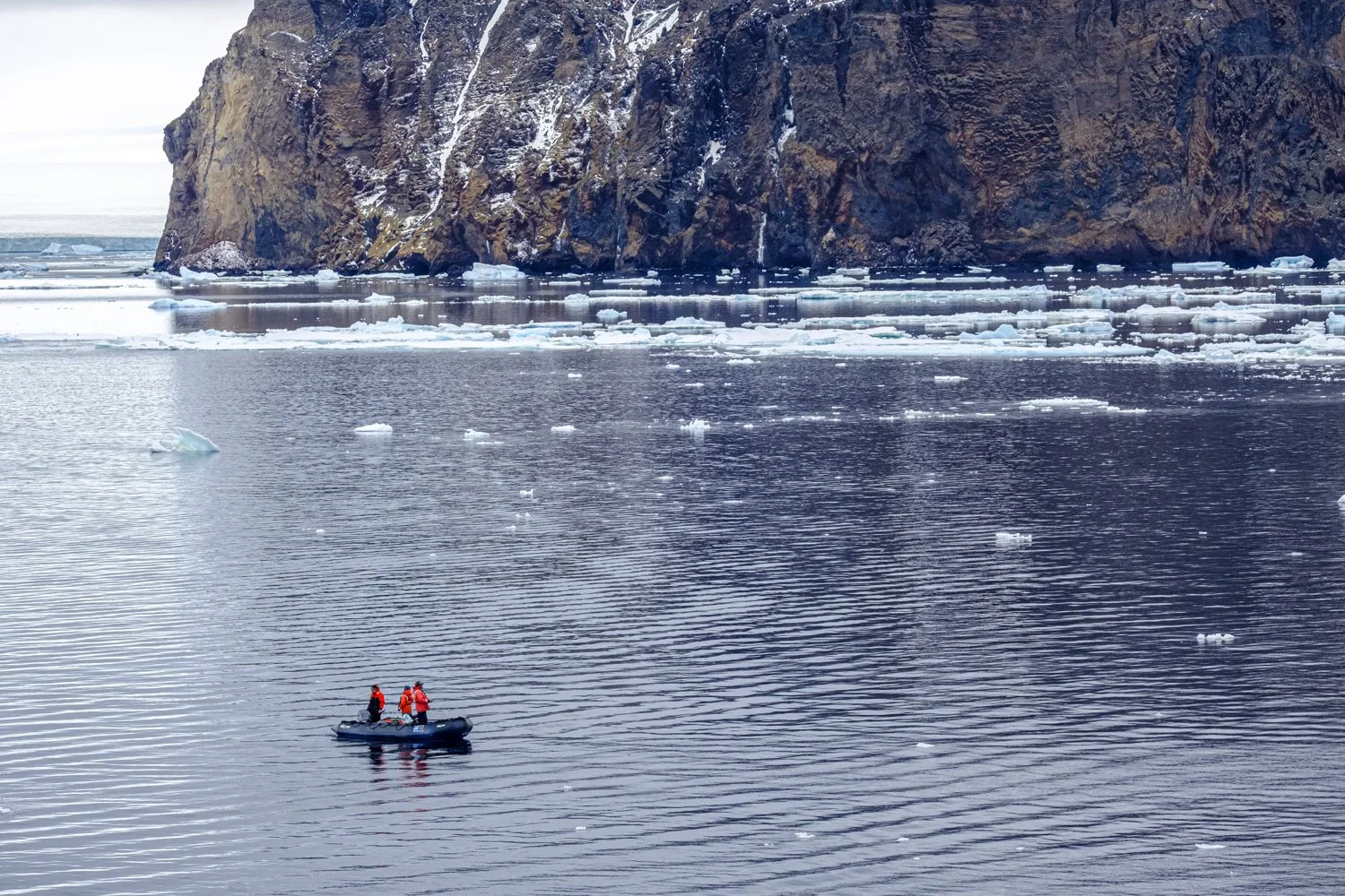
NOAA scientists zodiaking through icy waters off the Antarctic Peninsula

Cove, off the shore of Paulet Island, Antarctica, ringed by rocks and ice and by part of a colony of penguins (Adelie)
Humpback Whale, Antarctica

Sunset in Weddell Sea, Antarctica

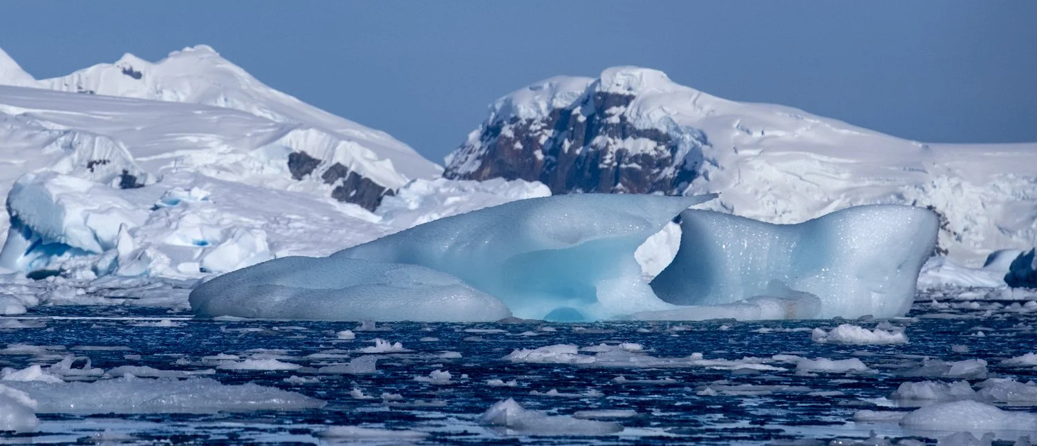
Iceberg and smaller ice formations after sunset, in the Weddell Sea, Antarctica

Moon over the Weddell Sea as sun sets, Antarctica

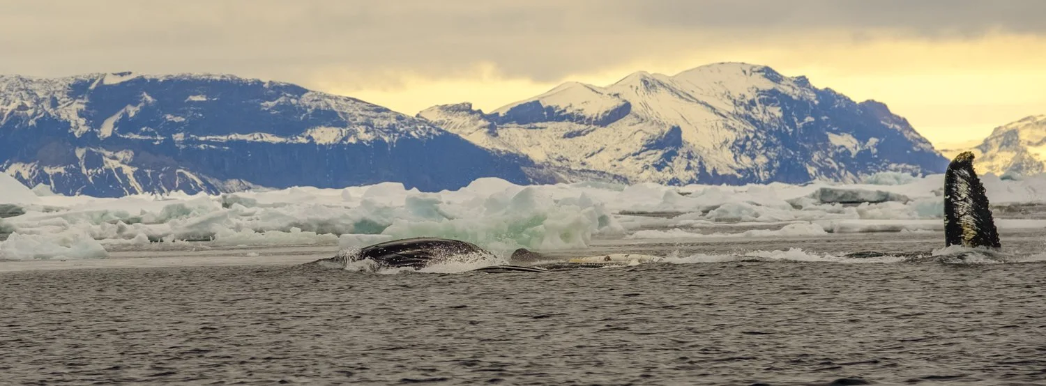
Sunset in Weddel Sea with two whales (foreground), Antarctica

Two small icebergs of differing colors, just before sunset, Weddell Sea, Antarctica

Ice formation being broken by ship, Weddell Sea, Antarctica

Leading part of significant tabular iceberg in bay off of Weddell Sea, Antarctica; note two zodiacs to get a sense of scale

Panorama of long tabular iceberg in a bay off of Weddell Sea, Antarctica, note two zodiacs to get sense of scale

Weddell Sea area bordered by mountains, as sun is setting, Antarctica

Moon over Weddell Sea, Antarctica, with picturesque iceberg

Lindblad Cove, Antarctic Peninsula, with small pieces of different categories of ice (e.g., pancake). US Gelogical Survey named the cove after Lars-Eric Lindblad, who in the 1960s pioneered environmentally responsible tourism in Antarctica (taken from kayak)

Lindblad Cove, Antarctic Peninsula, with small pieces of different categories of ice. US Gelogical Survey named the cove after Lars-Eric Lindblad, who pioneered environmentally responsible tourism in Antarctica (taken from kayak)

Panarama of Lindblad Cove off of the Antarctic Peninsula and the bow of our ship. US Gelogical Survey named the cove after Lars-Eric Lindblad, who pioneered environmentally responsible tourism in Antarctica

Kayaking through pancake and other types of ice in Lindblad Cove off of Antarctic Peninsula. US Gelogical Survey named the cove after Lars-Eric Lindblad, who pioneered environmentally responsible tourism in Antarctica
Picturesque iceberg in Lindblad Cove off of Antarctic Peninsula. US Gelogical Survey named the cove after Lars-Eric Lindblad, who pioneered environmentally responsible tourism in Antarctica (taken from kayak)

Kayaking through a field of pancake ice in Lindblad Cove off of Antarctic Peninsula. US Gelogical Survey named the cove after Lars-Eric Lindblad, who pioneered environmentally responsible tourism in Antarctica

Kayaking through Lindblad Cove off of Antarctic Peninsula. US Gelogical Survey named the cove after Lars-Eric Lindblad, who pioneered environmentally responsible tourism in Antarctica

Iceberg formation in Lindblad Cove, off of Antarctic Peninsula. US Gelogical Survey named the cove after Lars-Eric Lindblad, who pioneered environmentally responsible tourism in Antarctica (taken from kayak)

Rock formations of shoreline of Lindblad Cove, off of Antarctic Peninsula. US Gelogical Survey named the cove after Lars-Eric Lindblad, who pioneered environmentally responsible tourism in Antarctica (taken from kayak)

Rock formations of shoreline of Lindblad Cove, off of Antarctic Peninsula. Kayaks give a sense of scale. US Gelogical Survey named the cove after Lars-Eric Lindblad, who pioneered environmentally responsible tourism in Antarctica (taken from kayak)

Kayaking through field of pancake and other ice in Lindblad Cove, off of Antarctic Peninsula. US Gelogical Survey named the cove after Lars-Eric Lindblad, who pioneered environmentally responsible tourism in Antarctica

Waters of Lindblad Cove, off of Antarctic Peninsula, carved a passage in this iceberg through which water flowed. US Gelogical Survey named the cove after Lars-Eric Lindblad, who pioneered environmentally responsible tourism in Antarctica (taken from kayak)

Ice and rock formations of shoreline of Lindblad Cove, off of Antarctic Peninsula. US Gelogical Survey named the cove after Lars-Eric Lindblad, who pioneered environmentally responsible tourism in Antarctica (taken from kayak)

AntarcticaOur ship framed by an iceberg in Lindblad Cove, off of Antarctic Peninsula. Taken from a kayak. US Gelogical Survey named the cove after Lars-Eric Lindblad, who pioneered environmentally responsible tourism in Antarctica (taken from kayak)

Picturesque iceberg in Lindblad Cove, off of Antarctic Peninsula. Taken from a kayak. US Gelogical Survey named the cove after Lars-Eric Lindblad, who pioneered environmentally responsible tourism in Antarctica (taken from kayak)

Dramatic iceberg "sculpture" (perhaps mother nature's rendition of a ship) at night en route to Orleans Strait, Antarctica

The Orleans Strait, Antarctica. A narrow passage between the shores of two islands, possibly first discovered in 1820.

Lago Acigami in Tierra del Fuego National Park, Argentina

Beagle Channel, Tierra del Fuego, Argentina

Beagle Channel, Tierra del Fuego, Argentina

Beagle Channel, Tierra del Fuego, Argentina, a scenic protected area providing homes to imperial comorants, petrels and other birds

Les Eclaireurs Lighthouse protects seamen and vessels, Beagle Channel, Tierra del Fuego, Argentina; imperial comorants, petrels and other birds flock to the small rock island

The harbor of the city of Ushuai (the "End of the World"), Tierra del Fuego, Argentina

Part of the harbor of Flatey Islands, Iceland. History goes back to an 11th century monastery and later there was a trading post. Now there are only about 15 year-round inhabitants, but people summer there and tourists visit.

Part of the harbor of Flatey Islands, Iceland. History goes back to an 11th century monastery and later there was a trading post. Now there are only about 15 year-round inhabitants, but people summer there and tourists visit.

Lighthouse for the harbor of Flatey Islands, Iceland. History goes back to an 11th century monastery and later there was a trading post. Now there are only about 15 year-round inhabitants, but people summer there and tourists visit.

The North Atlantic Ocean alongside the Latrabjarg Cliffs, which are nine miles long and rise 1,400 feet above sea level, are on edge of an Iceland peninsula that is Europe's western-most land mass

Sunset over the North Atlantic Ocean alongside the Latrabjarg Cliffs, which are nine miles long, rise 1,400 feet above sea level, and are on the edge of a peninsula in Iceland that is Europe's western-most land mass

Water from the waterfalls of the Dynjandi River flows into a fjord framed by treeless hillsides formed by glaciers, the Westfords Region, Iceland

A fjord, with mountains in the background, near the settlement of Djupavik, the Westfjords Region, Iceland

The North Atlantic Ocean abutting the cliffs of Grimsey island, which is about 24 miles from the coast of Iceland and within the Arctic Circle

The North Atlantic Ocean and a cove off Grimsey island, which is about 24 miles from the coast of Iceland and within the Arctic Circle

The North Atlantic Ocean abutting cliffs of Grimsey island, which is about 24 miles from the coast of Iceland and within the Arctic Circle; a haven for many birds (in season)

A cove alongside Grimsey Island, which is in the North Atlantic Ocean, within the Arctic Circle and about 24 miles from the coast of Iceland
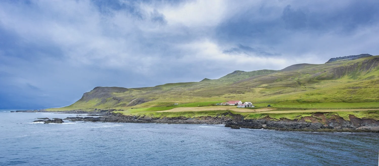
Cove leading to North Atlantic, near Bakkgeroi Iceland, with farm on right

Berufjordur Fjord, near the Fossardular Valley, Iceland

Sun falling on Mt. Vestrahorn, southeast Iceland, with fingers of glacier reaching to North Atlantic ocean

Afternoon sun on section of Vestrahorn mountain range, southeast Iceland,

Rough seas in North Atlantic off southern coast of Iceland

Alcatraz island and prison (closed), currently a tourist destination, San Francisco Bay, California

Golden Gate Bridge, San Francisco, California

Bark Bay, along coast track in Abel Tasman National Park, New Zealand

"Split Apple Rock", an unusual geological formation, in Tasman Bay, off coast of South Island of New Zealand

Little Kaiteriteri Beach, near Abel Tasman National Park, New Zealand

Cove with ring of rocks off East Coast of South Island of New Zealand near Kaikoura, a center for watching whales and other marine life

Queen Charlotte Sound, taken from town of Picton, in Marlborough Sounds Region of South Island of New Zealand
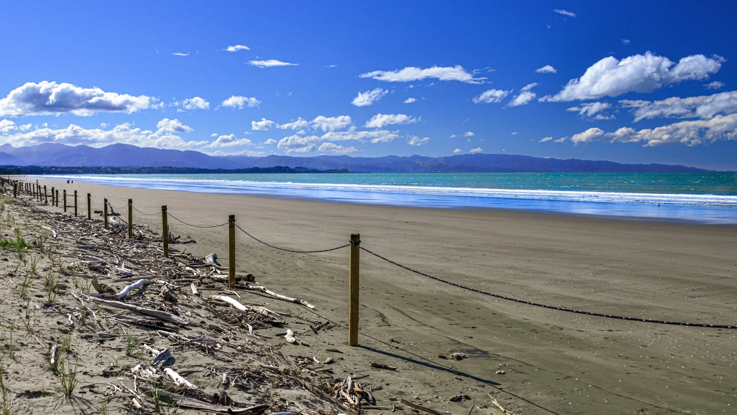
Tahunanui Beach on Tasman Bay; feature of city of Nelson on northwest section of South Island of New Zealand

Seas off of Taiaroa Head (with lighthouse), headland at end of Otago Peninsula, South Island of New Zealand

Boulders on Koekohe Beach on seacoast of Otago, South Island of New Zealand; Maori legend claims they are remains from the wreck of an ancient and large sailing canoe; geologists have explained they are rocks formed over millions of years beginning with "mudstone"

Allans Beach, Otago Peninsula, South Island of New Zealand

Tunnel Beach, southwest of Dunedin, New Zealand

Sandfly Bay, Otago Peninsula near Dunedin, New Zealand